
Prestige Park Ridge Location
Find Us
Bannerghatta Road | South Bangalore
Prestige Park Ridge on the map
Prestige Park Ridge is located in Anekal, on Bannerghatta Road in South Bangalore (560083), close to the metro, arterial roads and the airport route. The map below shows the exact site and what surrounds it.
- Address: Anekal, Bannerghatta Road, South Bangalore, Karnataka 560083
- Village: Anekal
- Taluk: Bangalore South
- District: Bengaluru Urban
- PIN Code: 560083
- Micro-market: Bannerghatta Road (State Highway 87), South Bangalore
- Latitude: 12.837753
- Longitude: 77.584326
- Google Plus Code: FH67+9X Bengaluru, Karnataka
- Land Area: 26.2 acres
- Configurations: 1, 2 & 3 BHK apartments
About Bannerghatta Road, South Bangalore
Bannerghatta Road is one of South Bangalore's most active residential corridors, linking the city to Anekal and the southern employment belt. Its blend of quick workplace access and a greener, calmer setting keeps demand along the stretch strong, which places Prestige Park Ridge in the middle of that growth.
Prestige Park Ridge by Prestige Group is located on Bannerghatta Road in South Bangalore, a settled neighbourhood with dependable access to the rest of the city. The project spans 26.2 acres and offers 1, 2 & 3 BHK homes.
Prestige Park Ridge is located at Anekal, Bannerghatta Road, South Bangalore, Karnataka 560083. On the map the site carries the Plus Code FH67+9X and lies at latitude 12.837753, longitude 77.584326.
The project is within a comfortable drive of the Electronic City IT corridor and the tech parks along the Bannerghatta Road stretch itself, with seamless access to reputed schools, colleges, shopping centres, malls and other key city landmarks.
Prestige Park Ridge Address

Prestige Park Ridge is addressed at Anekal, Bannerghatta Road, South Bangalore, Karnataka 560083, which falls under Bangalore South Taluk in Bengaluru Urban district. The site is at latitude 12.837753 and longitude 77.584326. With Bannerghatta Road giving easy movement in every direction, the address appeals to both investors and end-users.
Prestige Park Ridge Connectivity

Connectivity is central to how a locality grows. Areas with strong transport links are chosen first, whether the buyer is investing or developing, because an efficient network multiplies the economic and social value of everything built around it.
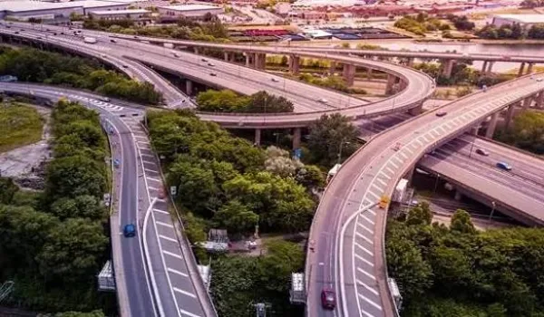
Prestige Park Ridge location is on Bannerghatta Road, one of the best-connected corridors in South Bangalore. The project location has easy access to every mode of transport – road, rail, metro and air. It is linked to all key areas of the city through a wide network of roads including NICE Road, Hosur Road, NH 44, NH 48, NH 275 and the Outer Ring Road.
The location provides straightforward access to the city's prime commercial districts and to its major transport hubs. Combined with proximity to quality education and healthcare, shopping and entertainment, Prestige Park Ridge offers a rare mix of modern infrastructure and green surroundings.
Road Connectivity
The project location is connected well through major highways, and the nearest bus stop is roughly a 5-minute walk away. BMTC buses and cab services operate through the location, which makes it easy for residents to reach every part of Bangalore. Bannerghatta Road itself feeds directly into the Outer Ring Road, NICE Road and Hosur Road, opening up routes to Electronic City, Koramangala, Madiwala, JP Nagar and the central business district.
BMTC Bus Connectivity
The project location provides easy access to major city bus stops, which is especially useful for working professionals commuting daily.
- Sampangiram Nagara bus stop – 180 m
- AMC College bus stop – 450 m
- Kalkere bus stop – 750 m
Air Connectivity
Residents of Prestige Park Ridge can reach Kempegowda International Airport at Devanahalli using NICE Road or the Outer Ring Road and then NH 44 (Bellary Road). The project location is roughly a 1-hour and 5-minute drive from the Bangalore airport, and the route avoids the most congested inner-city stretches.
- Kempegowda International Airport – 58.2 km
Metro Connectivity
Prestige Park Ridge has easy access to the upcoming Pink Line of Namma Metro, which will run between Kalena Agrahara on Bannerghatta Road and Nagawara on the Outer Ring Road. The closest metro station to this project location is Kalena Agrahara, reachable in about 15 minutes.
Nearest Metro Stations
- Kalena Agrahara metro station – 5.2 km
- Hulimavu metro station – 6.3 km
Rail Connectivity
The project location offers easy access to prime railway stations, which makes intercity travel simpler. The nearest terminus connects residents to destinations across Karnataka and the neighbouring states.
Nearest Railway Station
- KSR Bengaluru City Junction – 22.3 km
Bus Connectivity
- Sampangiram Nagara bus stop – 180 m
- AMC College bus stop – 450 m
- Kalkere bus stop – 750 m
Major IT Parks and Business Hubs near Prestige Park Ridge
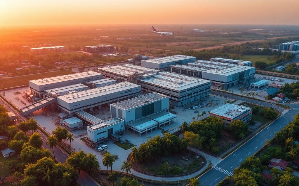
- Kalyani Magnum Tech Park – 4.2 km
- Shrum Tech Park – 4.2 km
- Progient Labs – 4.7 km
- IBC Knowledge Park – 5.5 km
- Infosys Technologies Limited – 6.5 km
- Oracle India Private Limited – 6.7 km
- Electronic City IT hub – 10.2 km
- BPL Telecom Private Limited – 11.6 km
- Accenture Services Private Limited – 12.9 km
Schools and Colleges near Prestige Park Ridge
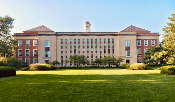
- Podar School – 5.2 km
- Holy Spirit School – 5.2 km
- EuroSchool – 6.3 km
- Mount St Joseph – 6.7 km
- Greenwood High School – 7.7 km
- The Little Crest – 7.9 km
- Maple Bear Canadian Pre-school – Bannerghatta Road
- Loyola Composite PU College – Bannerghatta Road
- Priyadarshini High School – Bannerghatta Road
- GIBS Business School – Bannerghatta Road
- Indian Institute of Management Bangalore (IIMB) – Bannerghatta Road
Hospitals near Prestige Park Ridge
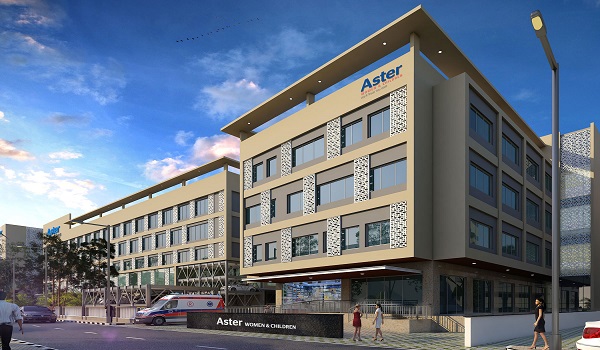
- Apollo Hospital – 1.2 km
- Sri Jayadeva Institute of Cardiovascular Sciences – 3.2 km
- Fortis Hospital – 3.8 km
- Aster RV Hospital – 7.8 km
- Rainbow Children's Hospital – 8.2 km
- Narayana Nethralaya – Bannerghatta Road
- Dr. Agarwal's Eye Hospital – Bannerghatta Road
- Vasan Eye Care – Bannerghatta Road
- Vivekananda Hospital – Bannerghatta Road
Shopping and Entertainment near Prestige Park Ridge
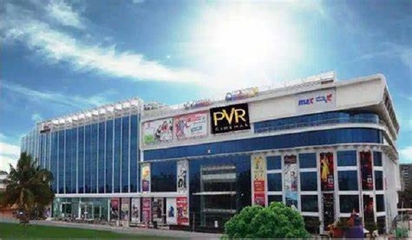
- Shoppers Stop – 4.7 km
- Royal Meenakshi Mall – 5.2 km
- Vega City Mall – 5.2 km
- Gopalan Innovation Mall – 6.6 km
- Reliance Smart – Bannerghatta Road
- Brand Factory – Bannerghatta Road
- Village Hypermarket – Bannerghatta Road
Things to See Around Prestige Park Ridge
Sri Champakadhama Swamy Temple – 2.2 km
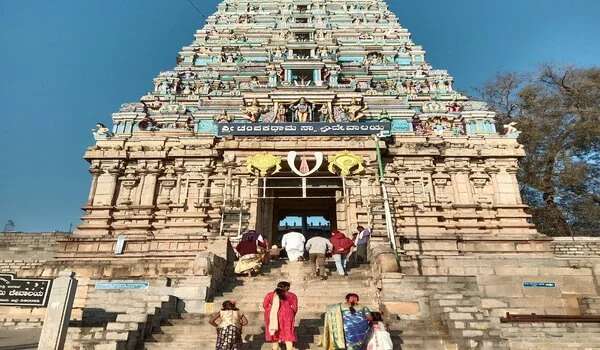
Sri Champakadhama Swamy temple, also known as the Lakshmi Narasimha temple, is devoted to Lord Vishnu and Ma Lakshmi. The deity is referred to as Sri Champakadhama Swamy because it is customary to offer the Champak flower (Sampige flower) to the Lord. The Suvarnamukhi pond, roughly 2 km from the temple, is believed locally to have medicinal properties.
The temple dates to the 12th century. Inscriptions found at the site show the structure was built in 1257 AD during the Hoysala period and later expanded under the Vijayanagara dynasty.
Bannerghatta National Park – 3.4 km
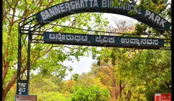
Bannerghatta National Park, set up in 1970 and granted national-park status in 1974, draws visitors for its safaris, rescue centre, zoo and butterfly park. Across its 260.5 sq km it runs lion and tiger safaris and a snake park, with walking and trekking trails and old temples still in worship. It opens daily from 9:30 a.m. to 5 p.m., closed on Tuesdays.
Six rustic settlements and three large enclosures used for sheep and cattle farming sit inside the park boundary, and visitors can see a wide range of species across the reserve.
Lalbagh Botanical Garden – 15 km
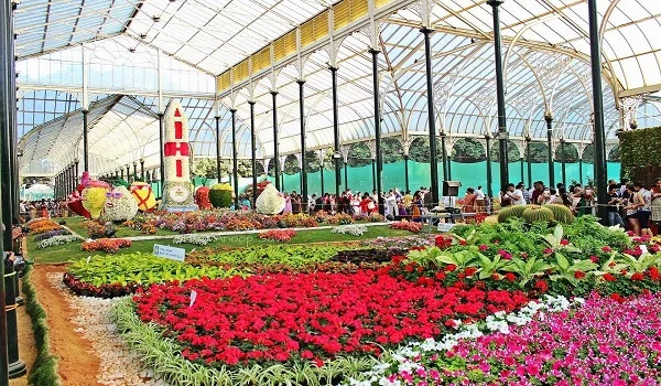
Lalbagh holds the largest collection of tropical and sub-tropical flora in India, spread across 240 acres in the heart of the city and home to several hundred-year-old trees. The garden is anchored by a watchtower built by Kempegowda, the founder of Bengaluru, standing on a rocky outcrop roughly 3,000 million years old that is recognised as a National Geological Monument.
The Lalbagh Glass House is a large glass-and-iron structure modelled on the Crystal Palace in London's Hyde Park. Built in 1889 and renovated in 2004, it remains the garden's main draw and hosts the twice-yearly flower shows.
HAL Heritage Centre and Aerospace Museum – 18.7 km
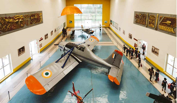
HAL Heritage Centre, opened in 2001, spreads over 4 acres. It showcases aircraft and fighter planes and includes a children's play area, a rose garden and a library. Tickets are Rs 70 for adults and Rs 30 for children, and the museum is open daily from 9 a.m. to 5 p.m.
Jawaharlal Nehru Planetarium – 19.2 km

The Jawaharlal Nehru Planetarium, named for India's first Prime Minister, stands on Sir T. Chowdiah Road across from the Indira Gandhi Musical Fountain Park and opened in 1989, one of five Nehru Planetariums in the country. Its 42-minute sky show plays through digital projectors on a 15-metre dome, with regular programmes like Our Solar System, Mars: The Red Planet and Dawn of the Space Age shown in Kannada and English.
The outdoor science park features models including Whispering Dishes, a giant Kaleidoscope, DNA and Sun Dial and Resonant Swings, and the centre also hosts science lectures, exhibitions, workshops and science theatre performances.
National Gallery of Modern Art (21.2 km)
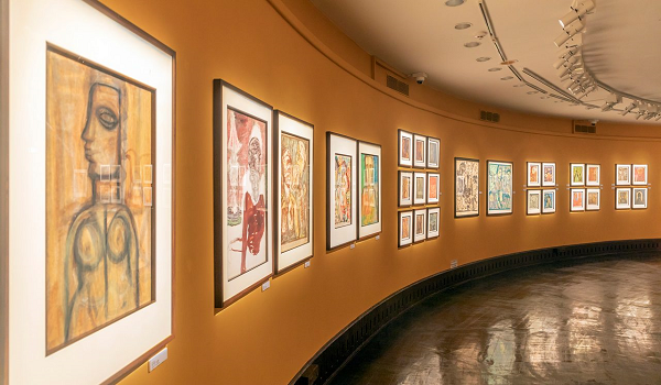
The National Gallery of Modern Art spans over 3.5 acres and opened on 18 February 2009. It holds 500+ exhibits of graphic prints, paintings and sculptures, featuring work by Jamini Roy, Amrita Sher-Gil, Raja Ravi Varma and Rabindranath Tagore. The gallery also has a garden with green space, trees, fountains and a mirror pool.
Cubbon Park – 21 km
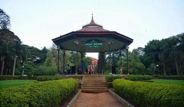
Cubbon Park was laid out in 1870 under Major General Richard Sankey and spans roughly 300 acres in the city centre. It hosts museums, a tennis academy, a library, an aquarium, a toy train and many statues, alongside natural rock outcrops, thickets of trees, grassy expanses and bamboo groves. The State Library occupies the red Gothic Sheshadri Iyer Memorial Hall inside the park.
The Karnataka High Court, Vidhana Soudha, Kanteerava Indoor Stadium, Freedom Park and the Visvesvaraya Industrial and Technological Museum all sit within a few kilometres of the park.
Muthyala Maduvu Falls (Pearl Valley) – 24 km
This waterfall is located in Anekal and is popularly called Pearl Valley. As the water cascades down over the surrounding rock and vegetation it takes on the look of a string of pearls, which is where the name comes from. The falls support a healthy bird population, and the surrounding hills are a regular weekend destination for trekkers.
Bannerghatta Road
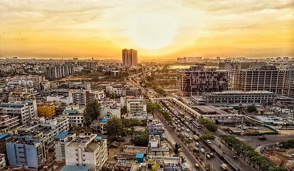
Bannerghatta Road is one of the defining neighbourhoods of South Bangalore. It has grown into an established residential and commercial centre and is expanding across every sector. The region carries a balance of well-maintained infrastructure and upmarket public facilities that is hard to find in newer corridors.
Its location, infrastructure depth, rising demand, variety of asset types, healthy rental returns and appreciation potential make it a credible option for investors. For end users, essential facilities and the main IT and tech parks are all within a short drive.
With an active real estate market, a settled address and dependable infrastructure, Bannerghatta Road has become popular among buyers looking to participate in the city's fastest-growing areas. The corridor is developing quickly and drawing developers and businesses from across India and beyond. As an established employment hub in its own right, it continues to attract both commercial occupiers and homebuyers, which is reflected in its steadily improving quality-of-life indicators.
Bannerghatta Road and its Connectivity
State Highway 87, widely known as Bannerghatta Road, runs south from Bangalore for a total of 49 km, from Adugodi to Anekal. Before being renamed after the adjacent Bannerghatta National Park, the route was known as the Anekal Road. It is well connected and functions as a key transport artery for the southern half of the city.
Access to major centres such as Electronic City, Whitefield, Madiwala, Koramangala and Hosur Road is straightforward from this location. Significant IT parks, business centres, hospitals, schools and entertainment venues sit conveniently nearby, which is what draws residential development to the corridor. The establishment of IT and business hubs in the surrounding area has driven the location's rapid expansion.
Metro Connectivity of Bannerghatta Road
The Pink Line is one of the Bangalore Metro's five principal lines, connecting important locations and strengthening public transport across the corridor. It will be central to keeping both residential and business locations accessible. The alignment runs roughly 21.3 km from Nagawara in North Bangalore to Kalena Agrahara on Bannerghatta Road in South Bangalore.
The Pink Line will have an interchange with the Purple Line at the MG Road station. It will also connect to the Blue Line at Nagawara and the Yellow Line at the Jayadeva Hospital station.
Major stations on the Pink Line:
- Kalena Agrahara
- Hulimavu
- Jayadeva Hospital
- IIMB
- Dairy Circle
- Tavarekere
- Lakkasandra
Airport Connectivity of Bannerghatta Road
Bannerghatta Road provides straightforward access to Kempegowda International Airport at Devanahalli, and travellers can choose between several routes depending on traffic. NH 44 (Bellary Road), NH 48 and the Outer Ring Road are the primary links between Bannerghatta Road and the airport, with NICE Road offering an alternative western approach.
Road Connectivity of Bannerghatta Road
Bannerghatta Road connects directly to the major arterial roads of Bangalore city:
- Outer Ring Road
- NICE Road
- Hosur Road (NH 44)
- NH 48
- NH 275
- Bangalore–Mysore Expressway
- Bellary Road
- Begur Road
- Dairy Circle
- MG Road
The proposed outer ring road is expected to improve the region's accessibility further, with better links to Old Madras Road, Hosur Road, Tumkur Road and Bellary Road.
Kempegowda Bus Station is around ten kilometres from the northern Bannerghatta Road localities such as Jayanagar and Dairy Circle, giving residents a direct link to the state and inter-state bus network.
Key Distances from Prestige Park Ridge
| Destination | Distance |
|---|---|
| Sampangiram Nagara bus stop | 180 m |
| Sri Champakadhama Swamy Temple | 2.2 km |
| Bannerghatta National Park | 3.4 km |
| Kalena Agrahara metro station | 5.2 km |
| Hulimavu metro station | 6.3 km |
| JP Nagar | 8.2 km |
| Electronic City | 10.2 km |
| Lalbagh Botanical Garden | 15 km |
| HAL Heritage Centre | 18.7 km |
| Jawaharlal Nehru Planetarium | 19.2 km |
| Cubbon Park | 21 km |
| National Gallery of Modern Art | 21.2 km |
| KSR Bengaluru City Junction | 22.3 km |
| Muthyala Maduvu Falls (Pearl Valley) | 24 km |
| Whitefield | 29.3 km |
| Kempegowda International Airport | 58.2 km |
| Evaluate natural light penetration planned for each of the 1,119 high-rise units. |
Frequently Asked Questions (FAQs)
Prestige Park Ridge is located at Anekal, Bannerghatta Road, South Bangalore, Karnataka 560083. The Google Plus Code is FH67+9X, and the coordinates are 12.837753° N, 77.584326° E.
Yes. The Sampangiram Nagara bus stop is 180 m away, the AMC College bus stop is 450 m away and the Kalkere bus stop is 750 m away. All three are served by BMTC.
Kalena Agrahara metro station is the nearest, at 5.2 km, followed by Hulimavu at 6.3 km. Both sit on the upcoming Pink Line, which runs between Kalena Agrahara and Nagawara.
Kempegowda International Airport at Devanahalli is 58.2 km from the project, roughly a 1-hour and 5-minute drive via the Outer Ring Road or NICE Road and then NH 44 (Bellary Road).
KSR Bengaluru City Junction is the nearest major terminus, 22.3 km from the project, and it connects to destinations across Karnataka and the neighbouring states.
The project connects through Bannerghatta Road (State Highway 87), the Outer Ring Road, NICE Road, Hosur Road (NH 44), NH 48 and NH 275.
The Outer Ring Road is reached directly along Bannerghatta Road, meeting it near the Hulimavu and Arekere stretch, which opens up routes towards Silk Board, Electronic City and the eastern IT corridor.
Kalyani Magnum Tech Park and Shrum Tech Park are both 4.2 km away, IBC Knowledge Park is 5.5 km and the Electronic City IT hub is 10.2 km from the project.
Podar School and Holy Spirit School are both 5.2 km away, EuroSchool is 6.3 km, Mount St Joseph is 6.7 km and Greenwood High School is 7.7 km. IIM Bangalore is also on the same corridor.
Apollo Hospital is 1.2 km away, Sri Jayadeva Institute of Cardiovascular Sciences is 3.2 km, Fortis Hospital is 3.8 km, Aster RV Hospital is 7.8 km and Rainbow Children's Hospital is 8.2 km.
Shoppers Stop is 4.7 km away, Royal Meenakshi Mall and Vega City Mall are both 5.2 km and Gopalan Innovation Mall is 6.6 km from the project.
Sri Champakadhama Swamy Temple is 2.2 km away and Bannerghatta National Park is 3.4 km. Lalbagh Botanical Garden is 15 km, and Muthyala Maduvu Falls, also known as Pearl Valley, is 24 km from the project.
Bannerghatta Road is an established South Bangalore corridor with mature infrastructure, steady rental demand and a wide range of asset types. Its proximity to Electronic City, the Outer Ring Road and the upcoming Pink Line metro supports continued appreciation.
JP Nagar is 8.2 km away, Electronic City is 10.2 km and Whitefield is 29.3 km from the project. Koramangala, Madiwala and the Hosur Road corridor are also easily reached.
The location coordinates are 12.837753° N latitude and 77.584326° E longitude, and the Google Plus Code is FH67+9X Bengaluru, Karnataka.
Guides
Prestige Park Ridge Blog


Explore the neighbourhood in detail
Download the brochure for a full connectivity map or speak with our sales team for directions to the site.